Related Posts Plugin for WordPress, Blogger...

Thursday, February 28, 2013

I-10 Irish Bayou exit in Louisiana

Leaving New Orleans on I-10, driving East towards Mississippi, and before the bridge over Lake Pontchartrain, there's an exit to Irish Bayou. I decided to get off there and take some photos because of this castle house. Behind this house is I-10.

DSCF2582a

And as you're driving I-10, off to the right, you'll also see the back side of this Quonset Hut house on stilts. When I was in the Navy, we lived in Quonset Huts on the Roosevelt Roads Naval Base in Puerto Rico.

DSCF2591a

More houses on stilts.

DSCF2584a

DSCF2585a

DSCF2589a

DSCF2593a

DSCF2594a

DSCF2595a

After photographing these houses at the Irish Bayou exit I continued on I-10 and drove to the Gulf Coast of Mississippi.

Sunday, February 24, 2013

Driving The French Quarter

I started the morning of Day 5 of my trip south taking video around the Manchac exit then continued on I-55 to New Orleans. I wasn't sure where I was going for the rest of the day and I saw a sign for the French Quarter Visitor Center so I went there to get directions and information. I ended up driving around the French Quarter for an hour or so after and I took more video. Here's some vidcaps. In the video (at the bottom) you'll see...

lots of cop cars
FrenchQuarter vidcap 01

workmen
FrenchQuarter vidcap 08

a skateboarder with a goofy hat
FrenchQuarter vidcap 11

a guy taking a smoke break
FrenchQuarter vidcap 12

a tour group on those two-wheel segway scooters
FrenchQuarter vidcap 13

and a workman up in the air
FrenchQuarter vidcap 15


Here's the video while I drove the one-way streets of the French Quarter in New Orleans, Louisiana on the morning of Friday, January 18, 2013. You'll see workmen, delivery men supplying the shops, bars and restaurants, a couple of tour groups, many police cars and a few of the local characters.


Monday, February 18, 2013

Pinwheels and such

I started with the Diva's Challenge for this week but wasn't getting anywhere, instead I ended up with these two drawings.

The first is 3 pinwheels.
DSCF3074b1s

This second would be the "such."
DSCF3083a1s

Thursday, February 14, 2013

Driving Louisiana I-55 South near the Manchac Exit


It's the morning of Day 5 of my trip from Detroit going south and finally it will be a sunny day. With a week or so off work I decided to go south and leave the overcast skies of Michigan for some sun.


I left Hammond, Louisiana early. The night before I had driven south down I-55 to scout some photo locations. First was from the Manchac Swamp Bridge near the Manchac exit and the only exit off this 22 mile bridge.

Here are three screen captures. And the video is below.
I-55 South vidcap1
I-55 South vidcap3
I-55 South vidcap2


The view out the window as I drive I-55 South in Louisiana near the Manchac exit. Music is from KLRZ 100.3 FM, the Rajun' Cajun. And you can listen online. The best time is from 6 am to 10 am Central time, Monday through Friday for the Hot Sauce Express show.


Looking back, I probably should have gotten off at the Manchac exit and driven along Old US 51 that parallels the bridge. And that's the problem with driving through. You only have one chance to capture a location.

Anyway, on to New Orleans.

Sunday, February 10, 2013

Down the Mississippi Delta - Part 2

It was Day 4 (January 17) of my trip south from Detroit. I got up early as usual and processed the previous day's photos and tried to map where I would drive.

I had stayed the night in Grenada, Mississippi at the Econo Lodge and what a treat. I haven't written my review for Trip Advisor yet but I agree with the others who gave this place a top rating. And I had the pleasure of also being checked in by the friendly, Shmeeka, behind the front desk.

I said back on my description of Day 2 that for the trip "all I had planned was to take back roads and listen to local radio as I drove," which I had been doing for the most part. By the way, in Kentucky and Tennessee, it was mostly Country/Western (with no Western). But in northwestern Mississippi, the music was either christian and gospel or classic rock; as I drove further south, it was mostly classic rock.


I drove back MS 8 and turned south on US 49W. I still wanted to drive the Delta but as far as sightseeing goes, the Mississippi delta is boring, at least in January, unless you like miles and miles of flat, flooded farm land.


So when I hit Moorhead, Mississippi, I took a short drive around.
DSCF2544a


seeing a bright, green house
DSCF2546a


Anyone bother to string a level line on this before they put the rafters up?
DSCF2547a


Moorhead, Mississippi definitely has some leveling problems or everyone tilts to the left.
DSCF2552a


there were a few untilted houses too
DSCF2548a


I didn't do much driving or taking pictures on Day 4. But it was sunny for the first time since I left Detroit. So it was a nice day.

I stayed the night in Hammond, Louisiana but it was still early and with a couple hours more of light I got back on I-55 and drove through New Orleans.

Thursday, February 7, 2013

Down the Mississippi Delta - Part 1

It's the afternoon of Day 3 of my trip south from Detroit and 800 miles later, it's still cold. The sleet and freezing rain storm that swept western Tennessee the night before had dropped some light snow in northwestern Mississippi.


I got off I-55 South and was driving MS 35 through Batesville. A policeman at one side of town was directing a dozen or more school buses into a parking lot. At the other side of town, another policeman was directing dozens of cars out a school parking lot. It was there I pulled over to take pictures of Sunny's Country Store.

DSCF2520a


DSCF2524a


DSCF2523a


and behind Sunny's were these 4 tanks.
DSCF2521a


Somehow I had lost MS 35 and found myself on US 278 where I saw this bizarre scene. What could have made all these trees naturally grow at that angle away from the road? Like a consistent wind was pushing them over the last decade or so it would take to grow to that height.

DSCF2535a

but from that was formed this natural arch with the row of trees behind
DSCF2539a

Looking at these pictures though, I believe I've figured out how these trees have grown away from the road. What's your guess? Any idea? Leave your answer in the comment section.

DSCF2537a

And driving the back roads, with nothing but miles of nothing out the windows, the mind wants to fill that gap. So what was this place? These two brick walls mark an entrance... but an entrance to what? 

DSCF2536a

It reminded me of a couple places I ran across years ago in Florida. They were ideas, like ghost towns without the town: the beginnings of a subdivision that never quite happened. Planned and mapped, you can drive the few empty roads and see where the house lots would have been. You can imagine the glossy pamphlets with drawings of tree shaded lots, children playing or maybe a future retirement village. But they fell through. Not enough investors and not much interest.

And this place. Whatever it was intended to be, didn't happen. So trees were planted.


I got off US 278 at Marks and started south on MS 3. It wasn't long before I took the last photos of the day at the John Lee Hooker marker on the Mississippi Blues Trail near Vance, Mississippi.

DSCF2540a


DSCF2542a


I drove MS 3 until it became US 49 West but in January, Mississippi sunset comes fast and dark around 5:30 pm. I was far from a motel room, so it was decision time. I looked at the map.

The guy back at the Welcome Center said that between Grenada and Jackson there were no motel rooms and there certainly weren't any where I was, so I decided to beat it back to I-55 by way of MS 8 and go to Grenada, rather than sit a 2 hour drive to Jackson.

Wednesday, February 6, 2013

Dansk

This week's Diva Challenge is to use the tangle Dansk. And it's always a challenge for me to draw long parallel lines. I don't know what this is but that's the beauty of the tangle. It just is what it is.


DSCF3043a2

Monday, February 4, 2013

Entering Mississippi on I-55


If you've been keeping track, back here, I was coming up to Huntingdon, Tennessee where I planned to turn south and make my way towards Mississippi but looking at the map, I still wanted to be further west. I got on Tennessee 22 at Huntingdon but then jumped onto I-40 to drive through Memphis so I could cross into Mississippi on I-55.


The last time I was in Mississippi was 1993. I took a solo, 6-week motorcycle trip around the country (Detroit to Wyoming, down to Arizona, across to Mississippi, then back up to Detroit).

Before that was in 1977. My US Navy Seebee homeport was down in Gulfport. I had lived there, between deployments (Subic Bay in the Philippines, Roosevelt Roads in Puerto Rico, and Diego Garcia, BIOT), for about 3 and a half years. I lived off base in an apartment building (no longer there) in Pass Christian and a year later in a trailer park off the bayou, northeast of the Seabee base.

ms coming home
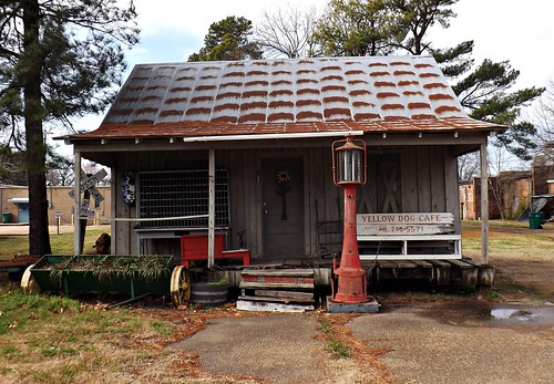
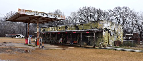
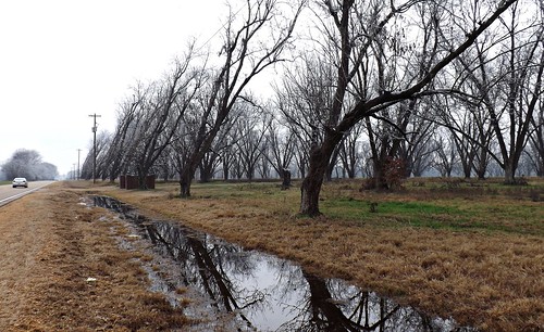
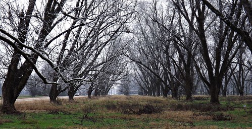
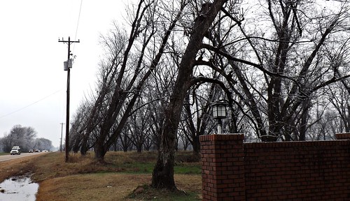
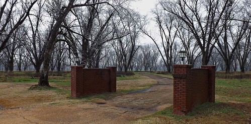
On this trip I had been entering each state by getting on the Interstate then stopping at the first Welcome Center rest stop for a quick in-and-out: pick up a free state map and a booklet for discounted motels. After that, I would break off and get on a back road to do some exploring.

I had always thought of Mississippi, and especially the Gulf Coast, as a second home. And having the friendliest people in the world. While I lived there in the mid-1970s, it seemed the most natural thing in the world to be walking along and stop to talk with a perfect stranger. Like I might have known them my whole life. And talk of nothing really. Nice day today... that kinda thing.

So coming down I-55 from Memphis I hit the first Welcome Center in Mississippi to get a state map and motel booklet. But, like the sign says, it was like coming home.

This Welcome Center was not like in other states. It wasn't fluorescent bright and stark with a couple cold benches and pamphlet racks. The lights were lower. Part of the space was lit with a table lamp. I thought I had walked into a neighbor's living room. There were pamphlet racks of course but it was homey, more like the entrance lobby of a bed and breakfast.

Behind the counter stood a nice lady and an older gentleman. They were warm smiles and c'mon over for a cuppa hot coffee and a chat. So I did.

I told him I was taking the back roads (though I thought I might get to Jackson) but heading towards the Gulf Coast. We talked for a bit.  He recommended a couple of the motels and offered to call ahead for me. But I told him I really had no idea where I would end up that night and I was anxious to get back on the road. He gave me a state map, a Gulf Coast map and the motel booklet with the notes he had written and his recommendations. I waved goodbye to them both and was back out to the car to look at the map and figure out where I would turn off I-55.


And there was another oddity along I-55. I wish I would have stopped to take a picture or written down exactly where I saw this as I drove.

Driving I-55 South, somewhere south of Jackson and looking to the right at an entrance ramp, there sits what might be a US Navy, Korean War era jet plane, on the other side of a fence in the thick woods.  Now I might be wrong that it's really Air Force and more 1960's but there it is, parked in a very wooded area with nothing else around.

As I drove further down I-55, I kept seeing that isolated jet plane in my head as a memory from years ago. I didn't think I ever traveled I-55 back in the 1970's but maybe I did once.


Well, oh well. I did a quick google search on "I-55 Mississippi jet plane." Seems like I was wrong about the type of plane but not the bizarre nature of its isolation. Here's a picture of it and the story. And there's more talk about it HERE at the MS Gun Owners forum. It's at the entrance from Hazelhurst, MS.

Anyway, mystery solved.


So, back to my trip...

It's early afternoon, Day 3 of my trip south, and I'm at the rest stop looking at the map. I decide to jump off I-55 at Batesville and MS 35 West. It seems like a good place to begin a back roads run to New Orleans. I figure to hit the Gulf Coast on my swing back north.

Friday, February 1, 2013

in my travels 4

A nice sign along US 62 in Clarkson, Kentucky. 
DSCF2386a


A little horsey at an antique stop in Kentucky.
DSCF2428a


Rosine, Ketucky is the Home of Bluegrass Music.
DSCF2410a


Rosine is the "Home of the First Family of Bluegrass Music: Bill Monroe, The Father of Bluegrass." And you'll like these pages for info and photos about Rosine, Bill Monroe, and Bluegrass.

DSCF2408a


Look at me. Along US 62 in Kentucky.
DSCF2370a


The Gold Gallery in Hopkinsville, Kentucky.
DSCF2445b


Dick's Liquor in Hopkinsville, Kentucky.
DSCF2460a

Related Posts Plugin for WordPress, Blogger...